|
Mountain Ranges:
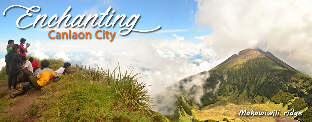
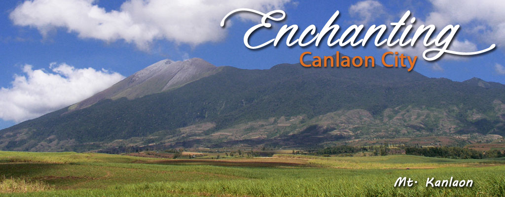
Canlaon is a name that evokes a familiar image that one of the most famous volcano that ever reared its head off. Mount Kanlaon is not as eye-filling symmetrical as Mayon volcano in the north, rather, Kanlaon Volcano rises swiftly like a womans proud and haughty breast thrust sharply in bold challenge against the sky. Against the cold, clear morning sky may often be seen white wispy wreaths of clouds garlanded around the crater-peak.
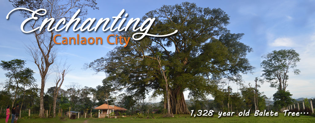
Valleys, waterfalls, caves, springs, and other scenic beauty are among the added features of this 16th highest peak in the country. And right where the massive sides of the volcano start tapering out into the broad plains over which it reigns supreme as far as the eye can see until the land fades into the blue waters separating Negros from Panay Island in the west and Cebu island in the east, there nestled and snuggles the gentle City of Canlaon.
Slopes:
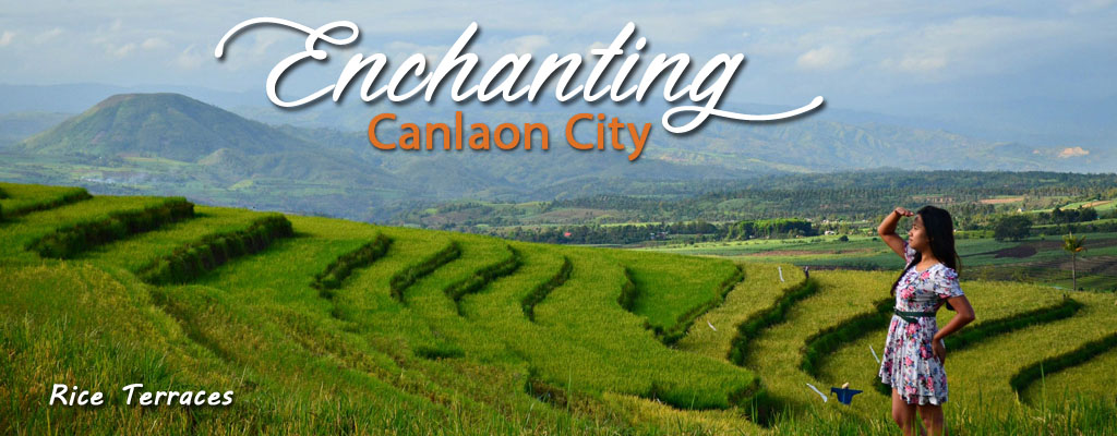
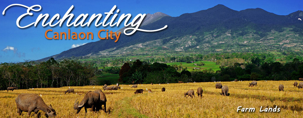
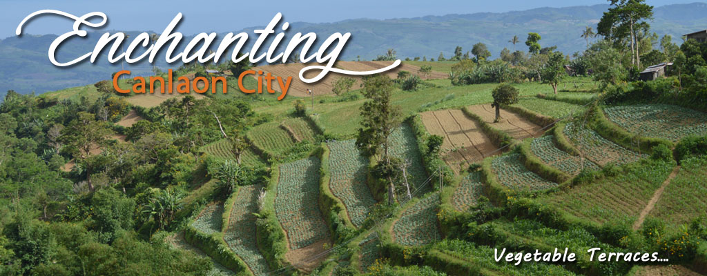
Canlaon City sprawls across the provincial divide between the twin-sister provinces of Negros. Approach from the south, one turns his back on the racing seas of the Tañon Strait and rides into the heart of the island over a winding and zigzagging highway that rises even more sharply and higher into the mountains. Then sharply again, the opposite hills rises gently into the ever-narrowing peak of Mount Kanlaon. As the city blooms into the horizon one can deduce the notion that it is blessed with one splendid beauty of nature, such a happy meeting ground between the gently rising farmlands through its rolling slopes stretching away from the sea on one hand, and the sharply-plunging curves of the volcano towering above it.
Water Bodies:
Canlaon City has one (1) major river and six (6) minor tributaries, namely:
1. Inyawan River
2. Masulog River
3. Linothangan River
4. Malaiba River
5. Bucalan & Budlasan River
6. Tokon-tokon River
Note: All these minor tributaries wind its way through mountain ravine and drains into Binalbagan River. It is the river flowing from its source at Barangay Lumapao through Barangay Binalbagan, Barangay Budlasan and wends its way down towards Negros Occidental and finally to the sea on the western side of Negros Island.
Climate:
Dry Season & Rainy Season:
The city usually experience rainy months from May to November. The months with the heaviest rainfall are July, August, September, October, and November, wherein which flash flood occur destroying agricultural crops. The dry season occurs from December to April. During dry spell, agricultural farms experience inadequate water supply causing reduction of production output of grains and other agricultural crops. Temperature can vary from a low of 16 degrees centigrade to a high of 37 degrees centigrade.
|